

Preface: SpaceNet LLC is a nonprofit organization dedicated to accelerating open source, artificial intelligence applied research for geospatial applications, specifically foundational mapping (i.e., building footprint & road network detection). SpaceNet is run in collaboration by co-founder and managing partner CosmiQ Works, co-founder and co-chair Maxar Technologies, and our partners including Amazon Web Services (AWS), Capella Space, Topcoder, IEEE GRSS, the National Geospatial-Intelligence Agency and Planet.
Building tracking and change detection from moderate satellite imagery is surprisingly tractable, as we’ve demonstrated in the last few DownLinQ blogs. The SpaceNet 7 Multi-Temporal Urban Development Challenge yielded some impressive results, with some interesting phenomena noted in analysis blogs 1, 2. This post serve as the final installment in the SpaceNet 7 analysis series, and we are pleased to announce that the winning models are now available in the open source. Furthermore, our paper on the SpaceNet 7 dataset and initial results can now be found on arXiv. In the sections below we explore performance with an interactive map, and provide details on how to access the models.
1. Winning Models
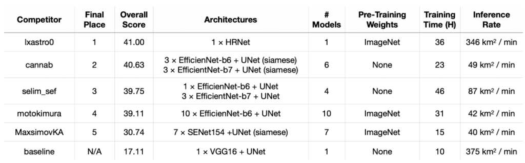
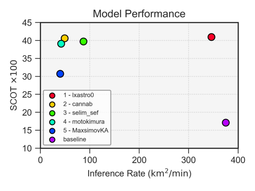
Recall from our results announcement blog that the top-5 submissions to SpaceNet improved markedly upon the SpaceNet 7 algorithmic baseline, and applied a variety of clever approaches to improve performance. Table 1 below details the specifics of each model, while Figure 1 illustrates the SpaceNet Change and Object Tracking (SCOT) score vs inference speed (for an in-depth analysis of SCOT scores, see our previous blog).
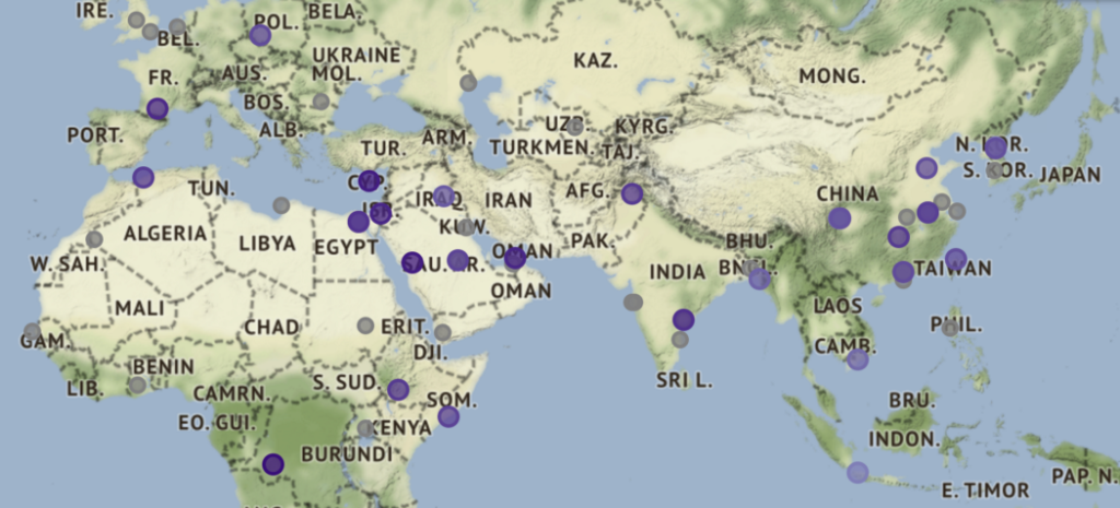
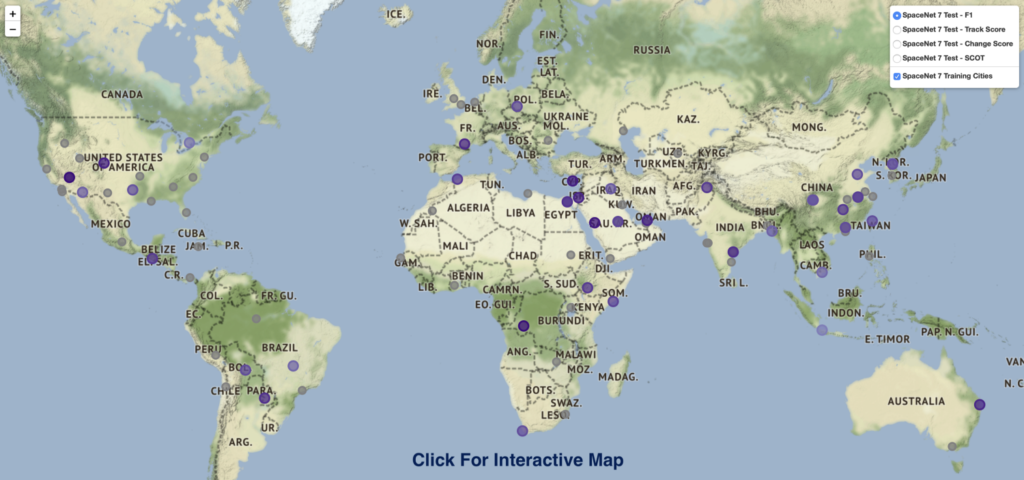
2. Interactive Map
Figure 2 links to an interactive (pan, zoom, hover) map that allows interested users to explore various metrics (F1, Track Score, Change Score, and SCOT) for the winning submission of lxastro0.
3. Tracking and Change Illustration
Figure 3 below provides an example of the winning model’s ability to correctly track building identifiers over time, as well as catalog change.
4. Model Access
The winning algorithms are available under a permissive license at:
https://github.com/SpaceNetChallenge/SpaceNet7_Multi-Temporal_SolutionsAll algorithms leverage Docker for easy deployment, and be either trained on new data or tested using existing model weights.
5. Conclusions
Quantifying population statistics is fundamental to dozens of the United Nations Sustainable Development Goals, yet many countries lack effective civil registration systems. SpaceNet 7 has demonstrated that identifying, tracking, and detecting change in precise building footprints using moderate resolution (4m) Planet imagery is possible. Tracking urbanization and construction at the unique building level is critical for improving upon existing course population estimates. By tracking unique building identifiers SpaceNet 7 algorithms can determine which exact buildings changed (whose properties such as precise location, area can be correlated with features such as road access, distance to hospitals, etc.), thus providing a much more granular view into population growth. We look forward to improvements upon these techniques permitted and encouraged by the open source nature of the dataset and algorithms.